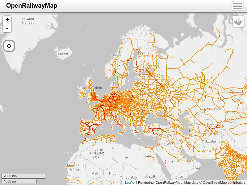
The Fire Information for Resource Management System (FIRMS) distributes Near Real-Time (NRT) active fire data from the Moderate Resolution Imaging Spectroradiometer (MODIS) aboard the Aqua and Terra satellites, and the Visible Infrared Imaging Radiometer Suite (VIIRS) aboard S-NPP, NOAA 20 and NOAA 21 (formally known as JPSS-1 and JPSS-2). Globally these data are available within 3 hours of satellite observation, but for the US and Canada active fire detections are available in real-time.


        Map with ships position all around the glob in real time


        Airly is the all-in-one air quality monitoring solution that helps local authorities, businesses and partners measure, analyse and act on air pollution with plug & play sensors, real-time data, powerful analytics and community impact tools.


        you can hear noises from all around the world here


        OpenRailwayMap (previously called "Bahnkarte") is a detailed online map of the world's railway infrastructure, built on OpenStreetMap data.


        Plan a bike route on traffic-free cycleways and quiet roads. Unique mapping, route photos, and free PDF and GPX downloads.